Quick Links
    Add a header to begin generating the table of contents
    Scroll to Top
    Loch Ness Map

    What you'll see...

    1

    Fort Augustus Abbey

    2

    Gorries Cave

    3

    Horse Shoe Scree

    4

    Cherry Island

    Sit back, relax and enjoy the beauty of Loch Ness in all its splendor. Listed on the map are a few key highlights.

    Spirit

    Safety and Shipboard Information

    Cruise Loch Ness welcomes you aboard.

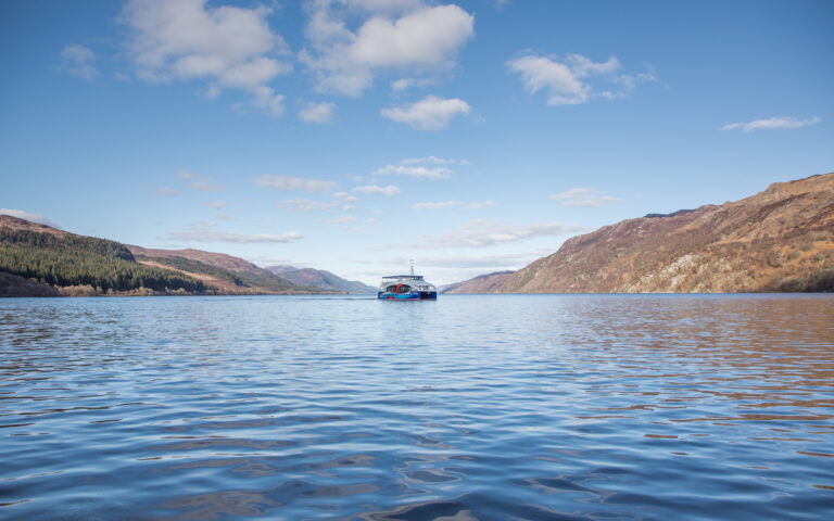
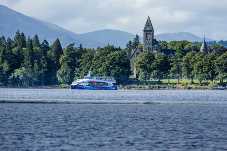
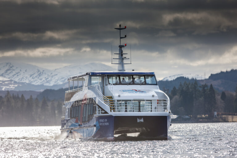
    This Cruise Loch Ness vessel is a custom built cruise ship which complies with the British Maritime and Coastguard Agency’s regulations.

    For your comfort and safety please listen to the following safety announcement.

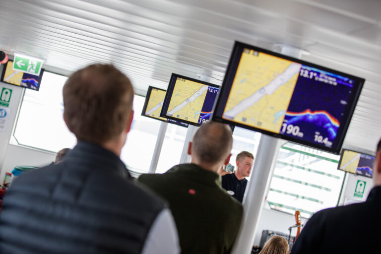
    In the unlikely event of an emergency please listen carefully to the instructions given through the vessel’s public address system and directions given by crew members.

    Life jackets are stored under the seats in the saloon and in marked boxes on both the lower back deck and upper deck. Instructions are clearly displayed in the saloon and in the wheelhouse window. Crew members will assist if required.

    Life rafts are located on the top back deck. These will deploy automatically or manually and crew members will instruct and assist you to board them. The captain asks all passengers with children to please be aware that running is not allowed on board and your children must be with you at all times.

    Please use the litter bins throughout the vessel and never discard rubbish over the side. The entire Cruise Loch Ness vessel is a NO SMOKING zone so there is no smoking anywhere on the vessel.

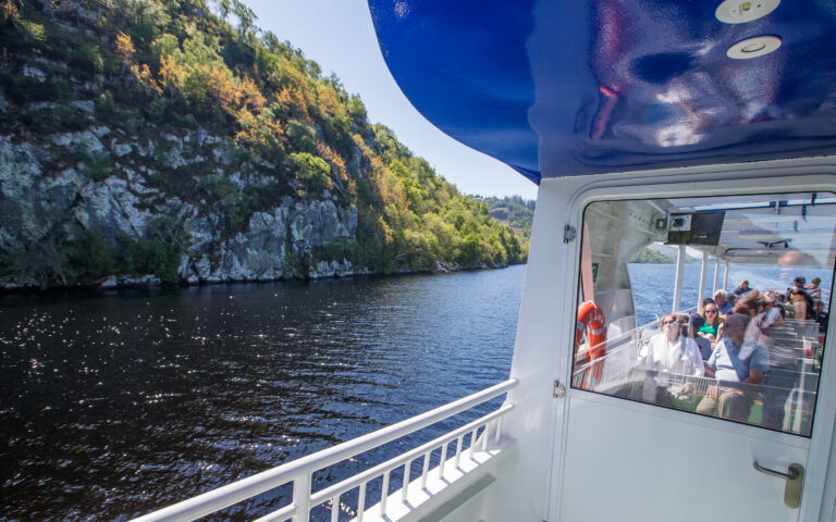
    We have a bar on the lower deck with a good selection of beers, souvenirs and, of course, malt whiskies.

    Toilets are located on the starboard (right) side for ladies and on the port (left) side for gentlemen.

    If you need any further help or information please feel free to ask a member of the crew.

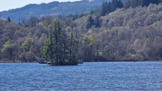
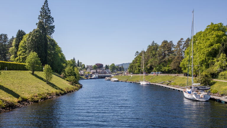
    So, now, sit back, relax, and enjoy the wonders of Loch Ness in the Great Glen of Scotland … but please don’t feed the monsters!

    Loch Ness

    Loch Ness

    You are travelling across the world famous Loch Ness, but there is more of interest in this deep dark valley than just the monster.

    Loch Ness is part of the Great Glen of Scotland, a geological fault line which runs from under the North Sea in the northeast to the edge of the Atlantic shelf in the southwest. It cuts Scotland in two.

    The rocks which form the Highlands of Scotland were laid down in warm tropical seas far to the south of the equator more than five hundred million years ago. Around four hundred million years ago, the continents of North America and Europe collided and this created an enormous mountain chain. Those mountains are known as the Caledonians. Twenty million years later the Great Glen fault line was formed and the mountains to the north of the loch slipped 65 miles (100 kilometres) to the southwest forming a huge valley.

    Eventually North America drifted away, the Atlantic opened and as the continents entered northern latitudes, they drew down upon themselves the great ice ages and our enormous jagged mountains were eroded to the stumps you see on either side of you during your journey today.

    When the last ice age finished, about twelve thousand years ago, Loch Ness filled with freshwater and took the form you see today. Vegetation and trees arrived, but most were cut down during medieval times to produce charcoal for smelting and the pine forests you see here today are mainly introduced species like Larch, Douglas Fir, Sitka and Norwegian Spruce and even some Sequoia.

    Our only native pine, the Scots Pine is best seen in nature reserves such as Glen Affric. Peat bogs stain the rainwater and it is that which makes the loch’s waters appear so dark.

    The loch is around 23 miles long, averages 1 mile wide and is 754 feet deep. That is 35 kilometres long, 1.5 kilometres wide and 230 metres deep. You could put the population of the world into Loch Ness more than three times over and it contains more water than all the lakes, rivers and reservoirs of both England and Wales combined including the whole of the English lake district.

    So … there is room for it to conceal a few mysteries.

    Boat Wake

    The Loch Ness Mystery

    Do keep your cameras to hand as you never know when you might be lucky enough to film or photograph something unusual on the loch.

    Whether the phenomena seen at the surface could be Nessie will continue to be debated and there are many theories on the subject. So, let us take a look at the history of the Loch Ness monster and see if it provides any clues. The first recorded sighting of a mysterious creature in the loch was in 565AD by St Columba, a Scots/Irish missionary who was preaching Christianity to the native Picts in the area.

    The story was probably just a parable to show the power of the church of the Christians. Sightings of a big fish occurred in the nineteenth and early twentieth century, but in 1933 the story suddenly exploded upon the world with a series of sightings and photographs. The most famous picture, that of a graceful neck protruding from the water, turned out to have been faked, but it will always remain the iconic image of the Loch Ness Monster.

    Scientists have shown that long necked animals could not live in the cold water owing to its temperature and the lack of an adequate food supply.

    Some will be mistakes, diving birds and even deliberate invention. The vast majority of sightings are of a single hump and those could be large living creatures. Sonar confirms strong contacts in the deep water – the domain of fish rather than air breathers. Sadly the bulk of evidence collected has been mistakes, fakes or difficult to interpret.

    One suggestion is that sturgeon may have been introduced to the river system and it is known they can live for centuries and grow to enormous proportions. The world record being 8.3 metres and over 240 years old. It might not be a very romantic monster, but at least it could be a real creature.

    Fort Augustus Abbey

    Fort Augustus and the Abbey

    There has been a community living at this end of the loch since earliest recorded times.

    Following Saint Columba’s attempt to convert the northern Picts to Christianity, the area moved back and forth between Pagan and Christian beliefs until, in the seventh century, Saint Cumin visited the glen. He built upon Saint Columba’s work and fully established Christianity in this part of the Highlands.

    He built a church here and the village became known as Cille Chuimein or Church of Cumin. It is still known by this name locally and the local school is the Kilcumen Academy. After the second Jacobite uprising of 1715 (Jacobites were supporters of the Catholic Stuart monarchy), General George Wade built a network of roads with Cille Chuimein at its centre.

    He also constructed a new fort here which he named Fort Augustus in honour of King George’s favourite son – William Augustus, the Duke of Cumberland. Once the fort was constructed, Fort Augustus became the English name for the village. The fort was enormous and solidly constructed with four heavily defended bastions at each corner. It housed a considerable military detachment.

    The last Jacobite uprising took place in 1745 and the fort was surrendered to Jacobite forces which had badly damaged it with cannon fire. In 1746 the Jacobites were defeated and the Duke of Cumberland, the man for whom the fort was named, decided to use it as his headquarters, but it was unusable. Cumberland was infuriated by the destruction and began a series of dreadful atrocities against the Highland people. The fort was never rebuilt after 1745 and Lord Lovat purchased it from the government and refurbished one building to use as a hunting lodge, giving it to Benedictine monks in 1878 who built the abbey attached to the fort foundations and remaining buildings.

    The monks operated it as a boarding school until 1993 and visitor centre until 1998. At the time it was the largest private visitor attraction in Scotland. Today these beautiful buildings are now converted into apartments and are no longer open to the public.

    Gorrie's Cave

    Gorrie’s Cave

    In the cliffs on the south side of the loch is the concealed entrance of Gorrie’s Cave.

    Gorrie’s real name was Alexander MacDonald, a notorious cattle thief. He used the cave as a hideout.

    As a survivor of the battle of Culloden, he was determined to assassinate the Redcoat commander, the Duke of Cumberland, in revenge for the beating taken by his fellow clansmen during the battle.

    Lying in wait on the hillside, he saw his chance when the Duke and his troops happened by. Gorrie’s blunderbuss was full of shot and nails. He remained hidden while he waited for the Duke to come into range.

    Unfortunately for Gorrie, the shot was a bad one and missed. He immediately turned to flee back to his cave and was pursued by the Redcoat soldiers who lost sight of him in the heather.

    With food and supplies being brought by his wife and other village folk, he managed to remain hidden in the cave for several months. Eventually the Redcoats gave up the search and the tale does not tell what finally became of this fugitive from Cumberland’s rough justice.

    Sonar Demonstration

    Sonar Demonstration

    For those of you on the top deck, if you come down to the saloon we are about to start a live presentation of the use of sonar systems in Loch Ness.

    Sonar is man’s only effective tool for conducting an underwater search. It relies on pulses of sound which reflect from objects in the water providing a return signal which can then be interpreted.

    In particular, sonar is able to detect objects which have different densities to that of water. The loch walls reflect strongly as they are made of stone, while the silty loch bed gives a weaker trace.

    Air reflects very strongly whereas flesh is almost the same density as water so reflects weakly. When searching for animals with sonar, it is the lungs in a mammal or reptile, or the swim-bladder in a fish which gives the bulk of the reflection.

    It is not possible to give a size of an object from sonar, only a strength. You might imagine the two are the same, but that is not the case. For instance a man swimming through the beam with an aqualung would appear very strong, but it is the aqualung and the air trapped in his mask and suit which gives the bulk of the reflection.

    When the 1987 Operation Deepscan obtained three very strong contacts, it was not possible to give a size because different animals have different contact strengths. An eel, for instance, has no air sac in its body so would have to be enormous to register at all.

    Experienced users of sonar can estimate the size of objects from past experience and Darrell Lowrance of Operation Deepscan estimated that their strongest contact was larger than a shark, but smaller than a whale.

    I’m sure most of us would be happy if Nessie were within that range.

    Horseshoe Scree

    Horseshoe Scree

    On the starboard side (right) you can see a large area of shattered rock which forms roughly the shape of a horseshoe, hence its name.

    One local tale tells that this is where the monster tried to escape, but it was too steep and she slipped back into the depths.

    A scree is caused by hundreds of years of seasonal weather. Water makes its way into crevices in the rock face. When it freezes the water expands and shatters the rock causing it to cascade down the hillside. You find many of these features in the Highlands. They can be very dangerous as the rocks can be easily disturbed and crash down upon anyone beneath.

    In 1985, monster hunter Steve Blackwell put a large cage in the water here and baited it with a net of salmon.

    The event was overseen by the Loch Ness Project for safety. The cage was successful in landing a Vodka company to sponsor the event, but the only monsters it captured were journalists looking for a silly-season story!

    The Peoples of the Great Glen

    The Great Glen is a natural line of communication through the Scottish Highlands.

    Once the ice departed 12,000 years ago, lichens, grasses and then trees colonised our hills and glens. Animals quickly arrived to exploit the developing environment and then, possibly some 8,000 years ago, mankind entered the glen.

    These were stone-age people who left little trace as they lived in caves and makeshift shelters, but we believe they crossed the English Channel from Europe when there was still a land bridge and made their way northwards over the next seven millennia.

    About 5,000 years ago the people began farming and formed communities. Around 500BC there was an invasion from Ireland. These were the Picts, the first of the Celtic peoples to arrive in this land quickly overcoming the remnants of the bronze age Highlanders.

    In the sixth century AD more Irish people arrived and these new arrivals were called Scots and were also Celtic.

    Within decades the Picts and Scots had unified and became known as Scotland. King Kenneth (843AD) is sometimes thought of as the first king of Scotland and Scotland is therefore the oldest kingdom in the world which is still a kingdom to this very day, so a proud and unique claim.

    Macbeth (unfairly maligned by Shakespeare) introduced the first police force in the eleventh century, but many battles marked the passing decades and Scotland was eventually overrun by Edward of England at the end of the thirteenth century, despite valiant efforts by William Wallace.

    In 1328 independence was finally secured by King Robert The Bruce and English claims on Scotland were f inally defeated. In fact, it is the Scottish royal line which prevailed and the current monarch of Great Britain and Northern Ireland is descended from King Robert The Bruce of Scotland.

    Who Were the Jacobites?

    After Robert The Bruce, there continued to be border disputes with England and there had been many attempts to unify the crowns.

    One of the better known of these was the arrangement for James the fourth of Scotland to marry the sister of King Henry the eighth of England which could perhaps lead to a unified crown. However, all did not go to plan and the French, who have always had a good rapport with the Scots, asked James to try to distract Henry from his interest in conquering Europe. The resulting battle was a disaster for the Scots.

    Years later James the fifth’s daughter, Mary Queen of Scots inherited the crown, but as a Catholic she was forced to abdicate in favour of her son, James the sixth and eventually she threw herself on the mercy of her cousin Elizabeth. A series of events, often inaccurately portrayed by Hollywood, resulted in her execution.

    When Elizabeth I of England died childless, James the sixth of Scotland inherited the English crown to accompany that of Scotland. This was the unification of the crown and he became known as James the sixth and first.

    When he decided to rule from England, effectively he gave Scotland to a greater Britain on a plate. Scotland’s own king had surrendered its hard fought Independence. Robert the Bruce would have turned over in his grave!

    King James’ grandson, James the seventh of Scotland and second of England converted to Catholicism and this threw protestant England into a panic. James’ daughter, Mary, and her husband, the protestant William of Orange, were invited to invade and James was overthrown. From the Latin for James, Jacobus, his supporters became the Jacobites.

    Uprisings failed in 1689, 1715, 1717 and by his grandson, Bonnie Prince Charlie in 1746 when he was defeated t the battle of Culloden.

    In 2014 there was a referendum to see if Scotland would like to separate from the rest of Britain. It was defeated by a very small margin. Some think it might be proposed again and that it was strange for a country to turn down its own independence. Others prefer the union for stability.

    All we can say on the Royal Scot is “Watch This Space!”

    Cherry Island

    Cherry Island

    If you look to your right as we approach the canal, you will see the only island on Loch Ness.

    It is called Cherry Island and is what is known as a crannog – a man-made island, probably built around the time of Christ. In the early twentieth century, one of the monks from Fort Augustus used an early diving suit to study its construction, which is mainly substantial trees crisscrossing each other for foundations.

    It was constructed as a defensive structure. Some Picts built homes on islands with access walkways to shore. Not only did these provide protection from wild animals and easy access for fishing, but they were also very easy to defend. If an enemy were attacking, firstly they would find it difficult to gain access and, in most cases, would just steal some animals and move on. If however it was a more substantial force, the walkway could be burned, preventing the enemy gaining access at all.

    There are many crannogs in Scotland and several have been studied by archaeologists who have found charcoal along the line of the submerged walkways, showing that this tactic had been used on several occasions.

    When the Caledonian Canal was constructed, the water level was raised by two metres. This is causing waves to erode Cherry Island and it will one day sink into the loch.

    Caledonian Canal

    Caledonian Canal

    As we approach the entrance to the Caledonian Canal we are reaching the end of our cruise adventure on Loch Ness.

    The canal itself is remarkable in its own right and, once you have disembarked, we recommend that you walk up the flight of locks to get a feel for this wonder of pre-Victorian construction which was built during the reigns of George III and George IV.

    It was built between 1803 and 1822, is 60 miles (95km) long, rises to 150 feet above sea level (45m) and comprises 39 locks, 10 bridges and 4 aqueducts. The construction engineer was Thomas Telford. Of the length of the canal, almost two thirds are made up of the natural Loch Ness, Loch Oich and Loch Lochy.

    It was constructed to provide a safe passage through Scotland to save ships from travelling the more treacherous route around the north of Scotland which was susceptible to storms and French privateers.

    Shortly after opening, the construction of larger steam ships meant that its usefulness was restricted and it might have been forced to close. It survived that and many other attempts to close it, the last of which was in the 1990s and today it is a subsidised protected monument.

    Commercial vessels do use the canal but it is now primarily used by tourist vessels such as ours and many cabin cruisers and barges.

    There is a Canal Museum on the right hand side of the staircase of locks if you would like more information.

    Our cruise today is now complete and we will shortly be manoeuvring to our berth so please remain seated until instructed by the crew.

    We hope you have found the cruise to be an enjoyable and educational experience and would appreciate you recommending the Royal Scot to people you meet during and after your vacation.